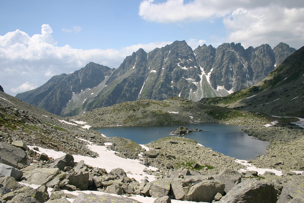
Hike to the Rysy is one of the most popular but also the hardest hiking path which earned its popularity mostly for the beautiful view. The view from the very top brings on the unforgettable feelings of triumph.
The Rysy, mountain in the High Tatras, has three peaks; the highest peak with its altitude of 2499 meters above sea level is situated in the middle and is accessible without a mountain guide.
The second one is the north-west peak, situated on the Polish side, which is the highest peak of Poland.
South-east peak is the smallest one with its altitude of 2 473 meters above sea level.
The Rysy is a border crossing which is open and freely accessible to Slovak and Polish citizens from July 1 st to September 30 th from 7 a.m. to 7 p.m.
TRANSPORTATION
The start of the hiking route to the Rysy, the lake Štrbské pleso, is accessible by any way of transportation.
Buses go from every bigger Slovak city but also from Štrba, Poprad, Svit, Liptovský Mikuláš and Spišská Nová Ves.
If you like to travel by train, our advice is to take the cog-wheel railway from Štrba or the Tatra electric tram from Tatranská Lomnica.
But if you choose the more comfortable way of travelling by car, use the road 18/E50 from both directions.
THE HIKE
When you want to enjoy the beautiful environment and conquer the exceptional hiking path of all times, choose the path to the Rysy.
The hike leads to the lake Štrbské pleso but the next stop is the
lake Popradské pleso.
You get there by following the red-marked hiking sign after an hour of walking.
From there, we follow the blue-marked hiking sign until we get to the valley Mengusovská dolina.
On the left side we can see the peaks Patria, Satan and Bašta.
After 30 minutes of ascent we come to a crossroads and from there we follow the red-marked hiking sign which guarantees a steep rise but
also magnificent rock-bound surroundings.
After a little while, our eyes are pleased by the lakes Žabie plesá which are 2000 meters above sea level and create an enchanting feast for the eye.
There are three lakes Žabie plesá, Malé Žabie pleso (1918 m), Veľké Žabie Pleso (1919 m) and Vyšné Žabie pleso (2040 m).
In the middle of the Veľké Žabie pleso stands a group of rocks which resemble a frog with a straightened right leg.
After all of the joy and amazement, it is time to continue with the hike.
The view at the lakes Žabie plesá from the bird’s perspective gives strength and suddenly we stand in front of the proudly dominating peak Vysoká (2547 meters above sea level).
Rocky landscape leads us to the chalet Chata pod Rysmi marked with the sign “Slobodné kráľovstvo Rysy” or “The Free Kingdom Rysy” which can be seen as a symbolic gate to the longed-for destination.
The chalet Chata pod Rysmi (2250 meters above sea level) has the highest elevation of all chalets in Slovakia and it offers meals, snacks and overnight stays from June 15 th to October 10 th.
There are wall ascents around the chalet which attract the rock climbers (e.g.: gallery Ganku).
The last part of the hiking path is also the hardest one.
“Crawling on all four” is required most of the time. Fortunately, fixed ropes and chains are provided.
Because of the high difficulty level, it takes about an hour to climb this path.
But it is definitely worth it.
From the very top we can see the majestic Tatras; the peak Gerlachovský štít (2654 meters above sea level) stands on the east and the ridge of Západné Tatry Mt. stands on the west side.
The tops of the peaks are covered in the white sea of clouds which increase the shade of mystery.
You immediately forget how hard it was to get to the very top.
On the way back, we are full of energy and optimism.
Do not forget that it is an all-day difficult hike, so it is important to wear an appropriate number of layers of clothing, hiking gear and footwear.
As it is technically demanding and requires being in a really good shape, it is not the right hike for children.
